
Latest satellite image (0300 Hrs GMT September 14, 2014) of Kalmaegi
Cyclone Kalmaegi approaches North Philippines with howling winds and torrential downpours. It will make landfall tomorrow night (local time), that the night of September 14, 2014. Winds will be in excess of 150 kph. Wave surge will be 10-12 meters or even more. The Batanes islands will be worst hit.
Kalmaegi will weaken as it passes over northern Philippines but will strengthen again as it enters South China Sea. It will hit the southern neck of Guangdong province on September 16, 2014, late night. Worst hit be the city of Zhanjiang which will see winds of 130 kph.
The typhoon will then move along the coastal areas of China in the Gulf of Tonkin and enter the area of border of Vietnam and China on the 17th of September. Though the winds will be less but the rains will be very heavy in North Vietnam.

Latest projected path of Kalmaegi according to JTWC.

Kalmaegi will strengthen again in the South China Sea. This is the forecasted position of the typhoon on September 16, 0000 hrs GMT.
-----------------------------------------------------

Northern Philippines coast will see waves surge by 12 meters.
--------------------------------------------
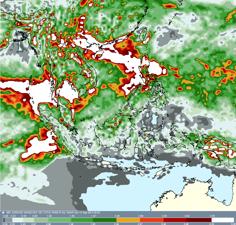
Total rainfall owing to Kalmaegi forecasted from now till September 18, 2014. The white patches show heaviest precipitation.
SIDELIGHTS: THIS LADY TAIWANESE FORECASTER HAS GOT IT RIGHT!
THIS VIETNAMESE WEATHERGIRL WARNS ABOUT KALMAEGI
SIDELIGHTS: THIS LADY TAIWANESE FORECASTER HAS GOT IT RIGHT!
THIS VIETNAMESE WEATHERGIRL WARNS ABOUT KALMAEGI


No comments:
Post a Comment